page rank 200
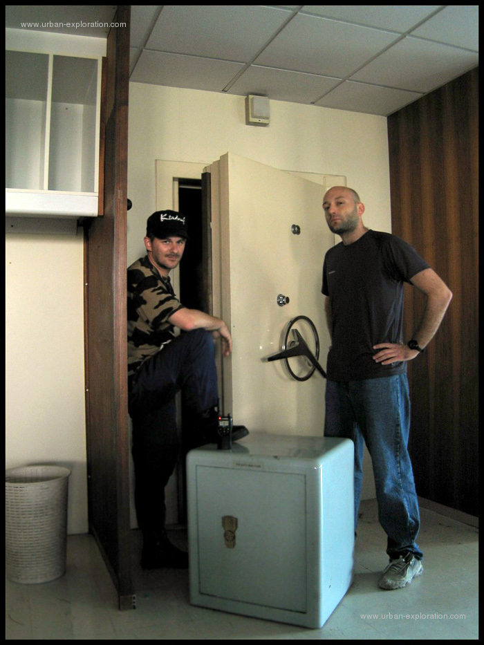
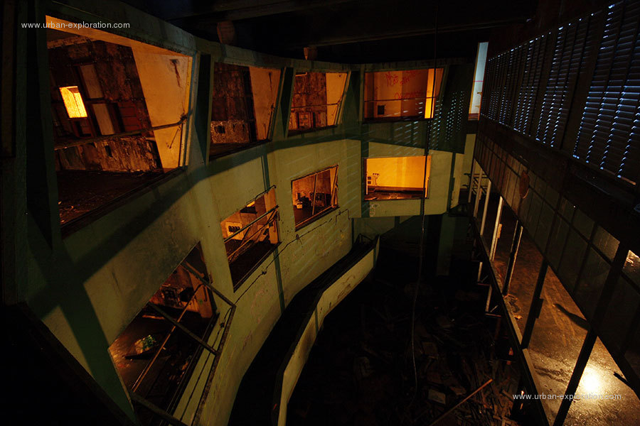
Some shielded trunks, in the administrative building of the factory.
page rank 200
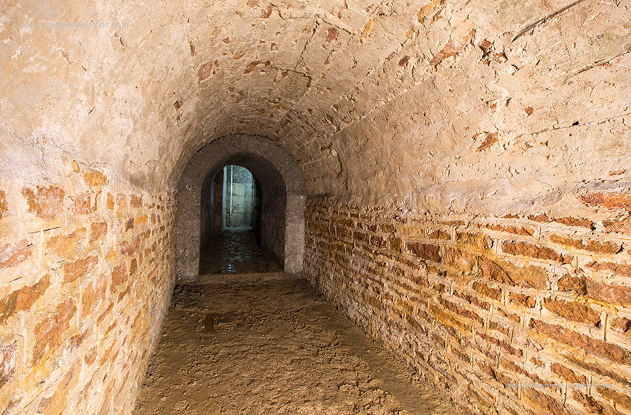
keywords : PANORAMICAL SPHERICAL STAIRS ARCH MILITARY FORT BUC 3D
Write the first comment
page rank 200
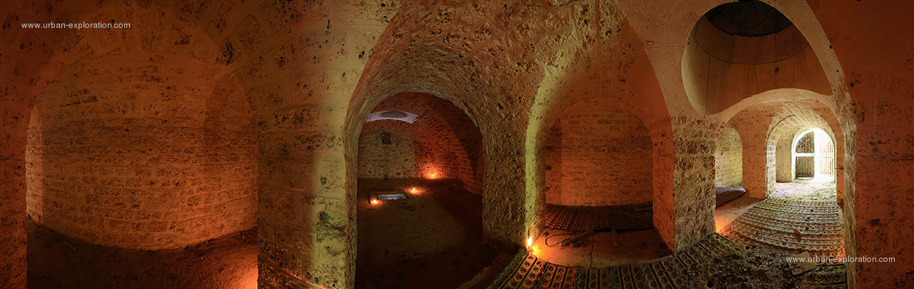
keywords : PANORAMICAL DOOR WELL PILLAR ROOM SPHERICAL MILITARY FORT BUC 3D
Write the first comment
page rank 100
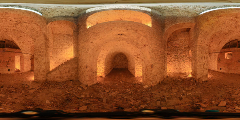
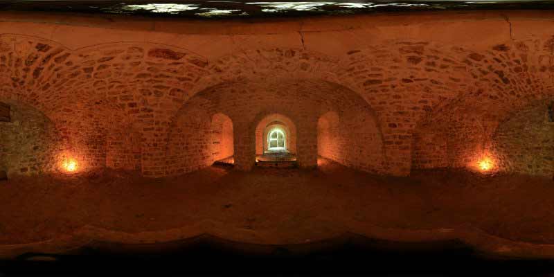
keywords : AERIAL ROOM DETECTION MAGINOT SALBERT NATO MILITARY HILL CENTER CONTROL
Write a comment - See the comment
Write a comment - See the comment
Control Room of the NATO radar base, the fort of Mount Salbert.
Fort Lefebvre culminates at the top of Mount Salbert 650m altitude. It said a strong "Sere River". It was built from 1874 to 1877. On May 12, 1955, NATO reuses the fort to house a communications center and a radar base. The book is officially delivered to the Air Force ole March 26, 1958. The book "G" Air Defense Planning (DAT) has 7 radio antennas. The old fort is used as a barracks for soldiers.
The radar base is not exactly the strong, but under the fort. Access from the fort is a long staircase of 322 stairs that descends into a concrete wall strongly.
The site is no longer running quickly but it remains occupied by the army until 1972. The mayor of Belfort is the current owner. It secures the site is now a promenade.
page rank 50
The most likely hypothesis of the origin of fish bones, given the structure of the network, is a military use, or at minimum, shelter and storage.
They were excavated during the construction of the royal citadel Saint Sebastian, symbol of royal authority against Protestants during the reign of Charles IX in 1564. The citadel was destroyed 20 years after the reign of Henry III. It will write up an order for its destruction, to avoid ridicule.
They were excavated during the construction of the royal citadel Saint Sebastian, symbol of royal authority against Protestants during the reign of Charles IX in 1564. The citadel was destroyed 20 years after the reign of Henry III. It will write up an order for its destruction, to avoid ridicule.
page rank 50
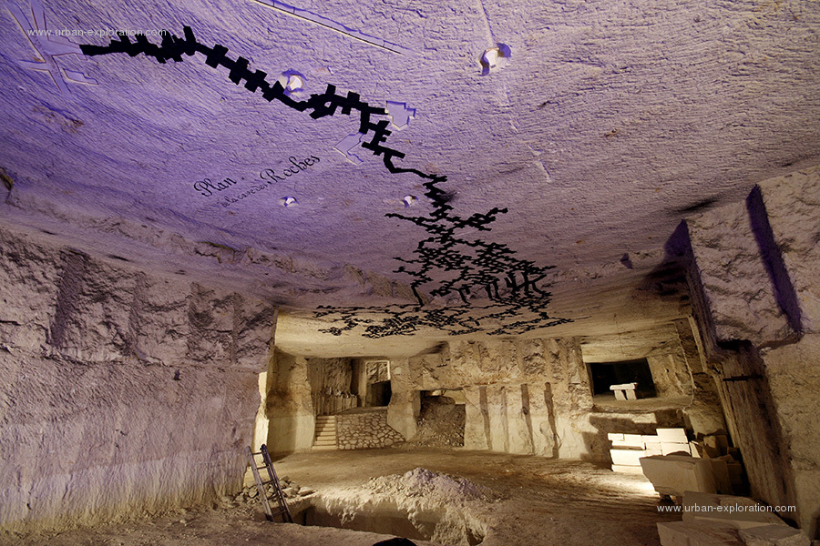
A crazy man who sculpts for years in quarry began his next room. At the time of the shooting, he was going to sculpt on the ceiling a map of the quarry.
page rank 50
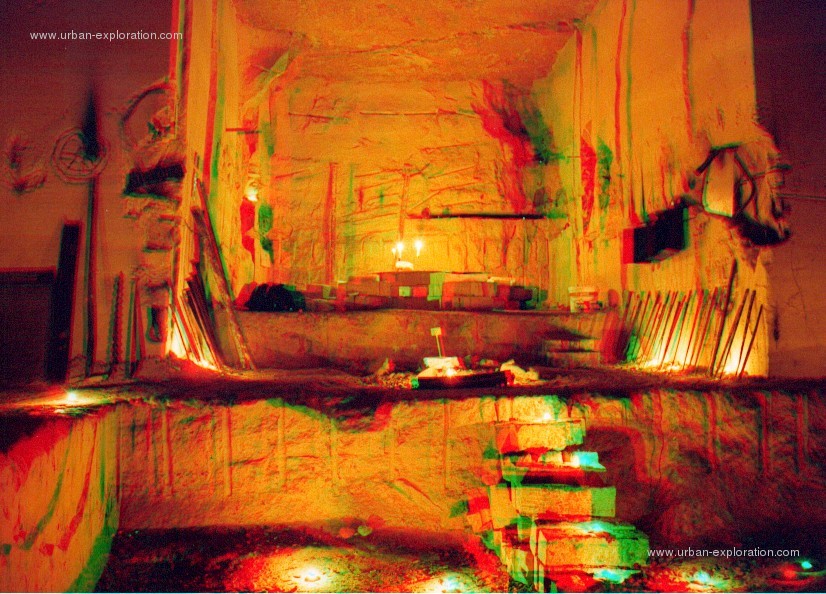
In the early 2000s, the quarry still housed many tools for quarrymen.
page rank 50
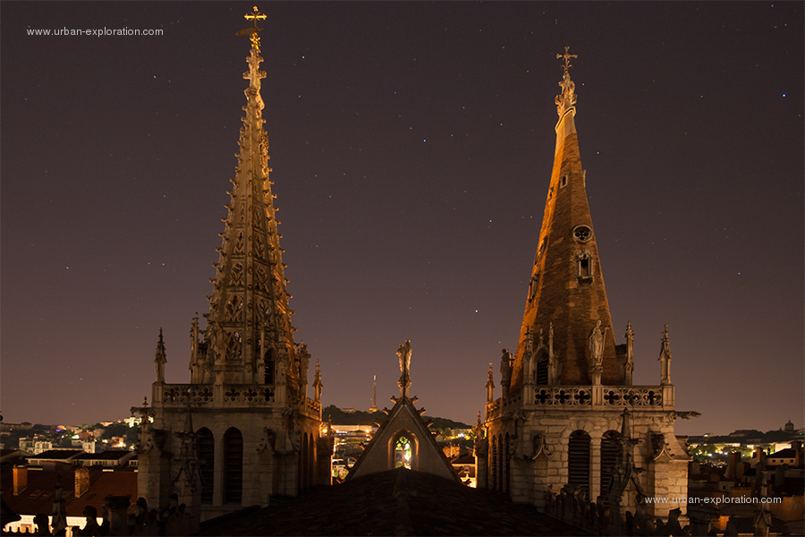
The two towers of the church of Saint-Nizier were not built at the same time, for budget reasons. In addition to that, its history is chaotic. The church was built on ancient ruins and partially destroyed and rebuilt.
page rank 50
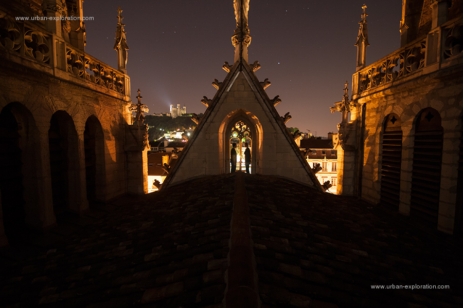
The Church of St. Nizier church is considered bourgeois. It is for this reason that it was partly destroyed in the 13th century. It is incomprehensible that this destruction was the work of followers of God, because God is love!
AQUATIC ARCH AXA BATTERY BIG BILLANCOURT BLOCK BOUGIVAL BOULOGNE BRIDGE BRITANNY BUILDING BUNKER BUTTRESS CASTLE CATACOMBS CATHEDRAL CB31 CENTER CHALK CHARTRES CHURCH CIMENTERIE CLINIC CONFLANS CORRIDOR COUTANCES CRANE CRUDE DEFENSE DENFERT DOME DOOR DRAWING ESSERENT ETIENNE FACTORY FACULTY FLYER FLYING FORT FRANCE FRONT GALLERY GLASSROOF GRS GYPSUM HERBLAY HONORINE HOUSE INDUSTRIAL ISLAND JAGUAR LADER LADY LEU LIMESTONE LYON MAGINOT MAHON MAP MARLY MEDICAL MEDIEVAL MERY MEUDON MILITARY MINE MINISTRY MONTALETS MONTESSON MONTROUGE MONUMENT MUSEUM MUSHROOM OCHRE OFFICIAL OISE OPERA ORANGIS ORSAY OSSUARY OUR PALACE PALAISEAU PANORAMICAL PAPERMAKING PARIS PAUL PENITENTIARY PILLAR POINT POND PONTOISE PORT PROVENCE QUARRY RAIL RAILING RENAULT RIS ROCHEREAU ROOFTOPS ROOM ROUDOUDOU SAINT SCHOOL SEGUIN SEINE SITE SOUTH STAIRS STATION STATUE STORE SWIMMING TECHNICAL THEATER TOWER TRIEL TROCADERO TUNNEL ULIS UNDERGROUND UNIVERSITY VARIOUS VAUX WAGON WALL WASTELAND WATER WELL
Last update 11.10.2015 - Check the latest news - Check the latest comments - About - Links
The database contains 2680 documents, 1342 descriptions, 3312 words, 964 synonyms and 167984 suggestions.
Buy a photography / Everything you wanted to know about urban exploration
Privacy policy - exploring the world since 1976...
Thanks: Alessia Strinati
Report a problem about the website Email me
ALL RIGHTS RESERVED - © 2001-2024 urban-exploration dot com © 1995-2024 roudoudou dot com